ParksMap Architecture
This section introduces you to the architecture of the ParksMap application, which you’ll use throughout this workshop. Understanding the architecture will help you better unsderstand the tasks you’ll perform from a developer’s perspective. ParksMap is a polyglot geo-spatial data visualization application built using a microservices architecture. It consists of multiple services developed using different programming languages and frameworks.
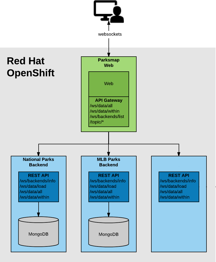
The main service is a web application with two key components:
-
Server-side component: Aggregates geo-spatial APIs provided by multiple independent backend services.
-
Client-side component: Built with JavaScript, it visualizes geo-spatial data on the map and communicates with the server-side using WebSockets to update the map in real-time.
You’ll deploy a set of independent backend services that provide various mapping and geo-spatial information, including:
-
Worldwide National Parks
-
Major League Baseball Stadiums in North America
The original source code for this application is located here.
The server-side component of the ParksMap web application acts as a communication gateway to all available backends. These backends are dynamically discovered using service discovery mechanisms provided by OpenShift, which will be discussed in more detail in the following sections.